U K Counties Map Color Coded PNG
A colorful political map of Great Britain with each county labeled and distinctly shaded against a black background.
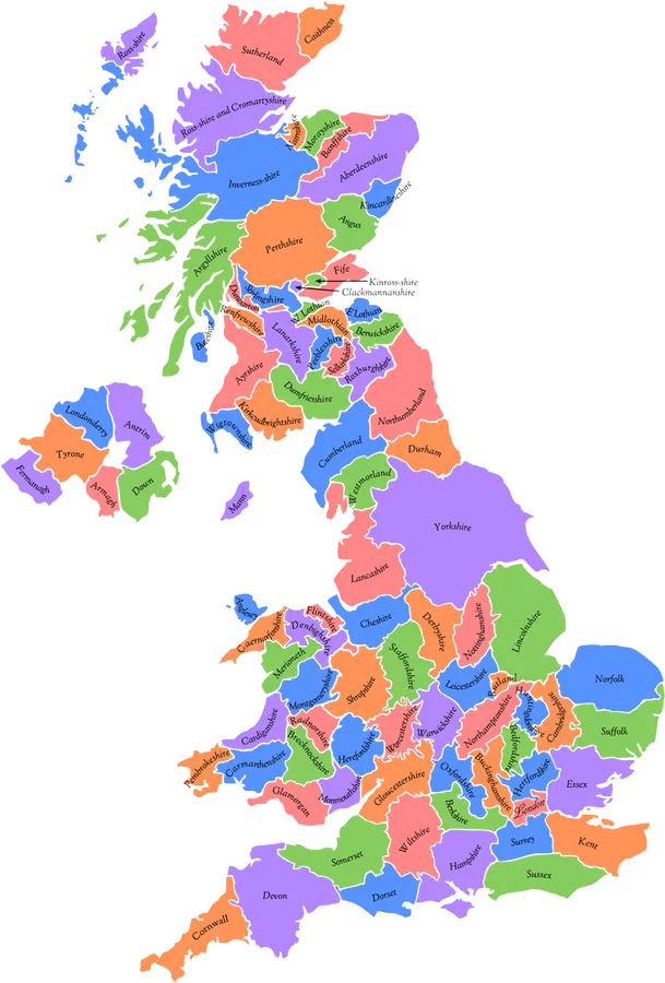
Image details 759 × 1121 · PNG · Dark grey
Size and format
- Resolution
- 759 × 1121 pixels
- Megapixels
- 0.85 MP
- Aspect ratio
- 2:3 · Portrait
- Best for
- Tablets — iPhone 4
- File format
- PNG
- Transparent background
- Yes
Colour
- Dominant colour
- Dark grey
- Main colours
- Teal
- Colour tone
- Cool
- Brightness
- Medium
- Contrast
- Medium
- Saturation
- Moderate
- Black and white
- No
- Colour palette
- Dark grey68%Royal blue15%Mint green6%Coral6%Salmon5%
Content
- Style
- Illustration
- Subject
- Britain map
- Mood
- Educational, informative, vibrant
Edit U K Counties Map Color Coded PNG
Browse all PNG tools ›









Related U K Counties Map Color Coded PNG
-

Man Cosplaying As Aquaman PNG -

Sexy Musician Britney Spears PNG -

A Sparkling Britney Spears Glows in Blue PNG -

The Bewitching Britney Spears PNG -

Britney Spears in stylish white fur coat PNG -

Britney Spears In Black Bodysuit PNG -

Britney Spears in a Little Black Dress PNG -

Britney Spears Signature Pose PNG -

Pop Star Britney Spears PNG -

Britney Spears Embracing Elegance in a Pink Dress PNG -

Pop Star Britney Spears Looks Vibrant and Colorful PNG -

Britney Spears looks stylish in a white blazer PNG -

Britney Spears Reaching for the Stars PNG -

Britney Spears having fun in pink and white PNG -

Pretty Hot Britney Spears PNG -

Throwback Look - Britney Spears from the 2000s PNG -

Britney Spears rocks her signature crop top PNG -

Britney Spears Showing Her Bright Smile PNG -

Britney Spears Surrounded By Her Fans PNG -

Britney Spears in Greyscale PNG -

Britney Spears flaunting her signature bangs PNG -

Britney Spears, the Princess of Pop PNG -

Britney Spears Becoming A Femme Fatale PNG -

Britney Spears brings her sparkle to the neon Vegas night on NYE PNG -

Young and innocent Britney Spears PNG -

The One, The Only Britney Spears PNG -

Britney Spears rocks a hipster look PNG -

Pop Icon Britney Spears on the Femme Fatale World Tour PNG -

A youthful Britney Spears PNG -

Alluring Britney Spears Up Close PNG -

Breathtaking lake views compliment the beautiful silhouette of the incredibly talented Britney Spears. PNG -

Sultry and Seductive PNG -

Britney Spears Smiling PNG -

The ethereal beauty of Britney Spears PNG -

Britney Spears strikes a sultry pose PNG -

The epitome of sexiness - Britney Spears PNG


📌 Boards
Build your own collection of png
Boards are free personal collections of wallpapers, backgrounds, PNGs and SVGs. Keep them private or share with one click.
Get this on your phone
Scan with your phone camera to open this page.